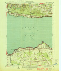
1944 Map of Jewell
USGS Topo · Published 1944About this map
Oneida Lake dominates this mid-century landscape, acting as a geographic divider between the rural uplands of Vienna to the north and the agricultural lowlands of Sullivan and Lenox to the south. Along the northern shoreline, the New York Ontario and Western RR runs parallel to the water, serving lakeside communities like Jewell and North Bay. This rail corridor was critical for the transport of goods and passengers during an era when local water transit was shifting toward the Barge Canal route through the center of the lake.
Find a feature on this map
48 named features on this map. Tap any name to fly to it.
Don’t see what you’re looking for? This feature index may not catch every label — zoom into the map to look around manually.
Map Details
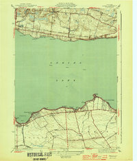
Editions of this 1944 Jewell Map
2 editions found
Other maps of this area

1895 · Chittenango
USGS Topo · 1:62,500

1895 · Oneida
USGS Topo · 1:62,500

1898 · Oneida
USGS Topo · 1:62,500

1898 · Chittenango
USGS Topo · 1:62,500

1902 · Chittenango
USGS Topo · 1:62,500

1902 · Oneida
USGS Topo · 1:62,500

1905 · Taberg
USGS Topo · 1:62,500

1906 · Kasoag
USGS Topo · 1:62,500

1939 · Oneida
USGS Topo · 1:62,500

1941 · Cleveland
USGS Topo · 1:24,000