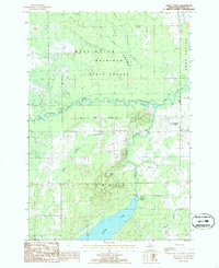
1986 Map of Jewett Creek
USGS Topo · Published 1986About this map
The Mackinaw State Forest dominates this Alpena County landscape, where the Thunder Bay River and its South Branch converge amidst extensive wetlands. The terrain is defined by its water systems, from the expansive Fletcher Pond and Upper Pond in the south to the Long Swamp and Long Rapids in the north. The presence of an Old Railroad Grade cutting through the forest provides evidence of the region's earlier industrial logging era, long before these lands were protected for state conservation.
Find a feature on this map
18 named features on this map. Tap any name to fly to it.
Don’t see what you’re looking for? This feature index may not catch every label — zoom into the map to look around manually.
Map Details
Editions of this 1986 Jewett Creek Map
This is the sole edition of this map. No revisions or reprints were ever made.
Other maps of this area

1954 · Tawas City
USGS Topo · 1:250,000

1954 · Alpena
USGS Topo · 1:250,000

1955 · Hillman
USGS Topo · 1:62,500

1957 · Alpena
USGS Topo · 1:250,000

1958 · Alpena
USGS Topo · 1:250,000

1958 · Tawas City
USGS Topo · 1:250,000

1969 · Alpena
USGS Topo · 1:250,000

1971 · Polaski
USGS Topo · 1:24,000

1971 · Lachine
USGS Topo · 1:24,000
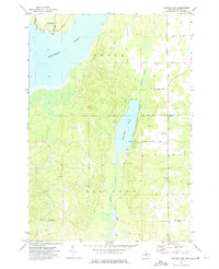
1972 · Beaver Lake
USGS Topo · 1:24,000