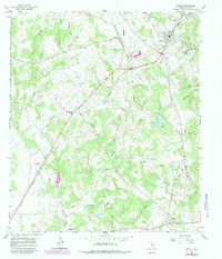
1965 Map of Jewett
USGS Topo · Published 1983About this map
Jewett serves as a central hub on this Leon County survey, positioned at a significant rail junction where the Missouri Pacific and Burlington Northern lines intersect. The surrounding landscape reflects a rural economy transitioning into energy extraction, with numerous gas wells and drill holes appearing alongside long-established farming communities like Newby and Concord. Local history is deeply embedded in the distribution of family-named landmarks and rural institutions such as the Sardis Ch and Independent Sch.
Find a feature on this map
37 named features on this map. Tap any name to fly to it.
Don’t see what you’re looking for? This feature index may not catch every label — zoom into the map to look around manually.
Map Details
Editions of this 1965 Jewett Map
2 editions found
Other maps of this area

1925 · Marquez No. 1
USGS Topo · 1:48,000

1927 · Marquez
USGS Topo · 1:62,500

1930 · Marquez
USGS Topo · 1:62,500

1954 · Waco
USGS Topo · 1:250,000

1955 · Waco
USGS Topo · 1:250,000

1956 · Jewett
USGS Topo · 1:62,500

1964 · Spring Seat
USGS Topo · 1:24,000

1964 · Margie
USGS Topo · 1:24,000

1965 · Jewett
USGS Topo · 1:24,000
1965 · Robbins
USGS Topo · 1:24,000