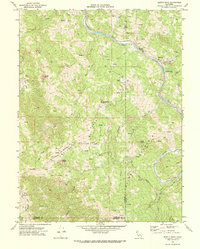
1969 Map of Jewett Rock
USGS Topo · Published 1974About this map
The Northwestern Pacific railroad corridor follows the winding course of the Eel River through this remote stretch of Northern California. Surveyed in the late 1960s, the map reveals a landscape defined by isolated homesteads and rugged topography where the borders of Humboldt, Trinity, and Mendocino counties meet. Local history is anchored by family sites such as White Ranch, Wood Ranch, and Lauffer Ranch, alongside smaller features like a lone Grave and a Cem near the banks of Jewett Creek. The presence of Kekawaka Sta and the Island Mtn settlement underscores the railroad's role as the primary artery for these river communities. High points like Jewett Rock and Schroeder Rock dominate the ridges, while various infrastructure elements including a Landing Strip, Pipe lines, and a Corral illustrate the mixed-use character of this rural mountain terrain.
Find a feature on this map
31 named features on this map. Tap any name to fly to it.
Don’t see what you’re looking for? This feature index may not catch every label — zoom into the map to look around manually.
Map Details
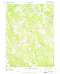
Editions of this 1969 Jewett Rock Map
2 editions found
Other maps of this area

1920 · Cummings
USGS Topo · 1:62,500

1920 · Covelo
USGS Topo · 1:62,500

1920 · Harris
USGS Topo · 1:62,500

1921 · Hoaglin
USGS Topo · 1:62,500

1922 · Island Mountain
USGS Topo · 1:62,500

1931 · Hoaglin
USGS Topo · 1:96,000

1935 · Hoaglin
USGS Topo · 1:125,000

1949 · Alderpoint
USGS Topo · 1:62,500

1951 · Alderpoint
USGS Topo · 1:62,500

1952 · Spyrock
USGS Topo · 1:62,500