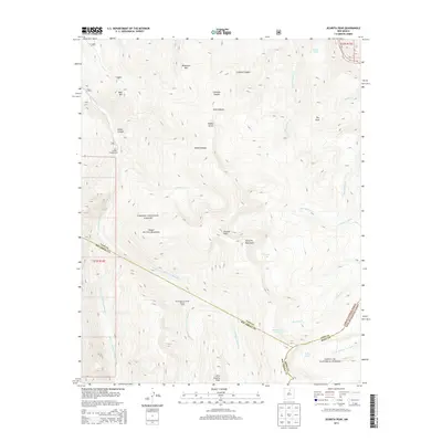
2013 Map of Jicarita Peak
USGS Topo · Published 2013About this map
Jicarita Peak stands as the central landmark in this high-altitude landscape where the Sangre de Cristo Mountains meet the Santa Fe Mountains. The map reveals a complex network of glacial and alpine water features, including Serpent Lake, Horseshoe Lake, and N Fork Lake, which feed the many branches of the Rio Santa Barbara. Human infrastructure is sparse and concentrated along the northern and western drainage basins, evidenced by the Santa Barbara Campground and the Santa Barbara Forest Cabin. A notable piece of high-country water engineering, La Sierra Ditch, traverses the eastern slopes near Rito Angostura. The terrain is defined by deep canyons such as Comales Canyon and Osha Canyon, providing a detailed look at the drainage patterns of the Carson National Forest and Santa Fe National Forest before they descend toward the more populated valleys.
Find a feature on this map
38 named features on this map. Tap any name to fly to it.
Don’t see what you’re looking for? This feature index may not catch every label — zoom into the map to look around manually.
Map Details
Editions of this 2013 Jicarita Peak Map
This is the sole edition of this map. No revisions or reprints were ever made.
Other maps of this area

1889 · Las Vegas
USGS Topo · 1:125,000

1889 · Santa Fe
USGS Topo · 1:125,000

1891 · Las Vegas
USGS Topo · 1:125,000

1893 · Las Vegas
USGS Topo · 1:125,000

1894 · Santa Fe
USGS Topo · 1:125,000

1954 · Santa Fe
USGS Topo · 1:250,000

1954 · Raton
USGS Topo · 1:250,000

1958 · Raton
USGS Topo · 1:250,000

1958 · Santa Fe
USGS Topo · 1:250,000
1963 · Truchas Peak
USGS Topo · 1:24,000