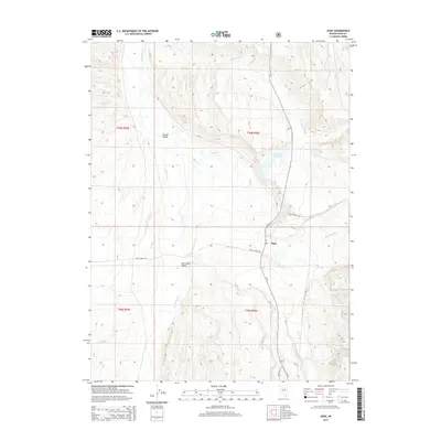
2015 Map of Jiggs
USGS Topo · Published 2015About this map
Mound Valley and Huntington Valley define this ranching landscape in Elko County, where the High Desert terrain is marked by a complex network of seasonal and perennial waterways. At the center of the sheet, the small settlement of Jiggs is identified near its Po, serving as a central point for the remote area. The hydrology is dominated by Huntington Cr and its many tributaries, including Smith Cr, Cottonwood Cr, and McCutcheon Cr. The Zunino Reservoir stands as a significant water management feature in this arid environment. Transportation through the valleys is facilitated by a grid of county roads such as CR-716 and Circle Ranch Rd, which connect the scattered homesteads and ranching operations characteristic of this region in the early twenty-first century.
Find a feature on this map
24 named features on this map. Tap any name to fly to it.
Don’t see what you’re looking for? This feature index may not catch every label — zoom into the map to look around manually.
Map Details
Editions of this 2015 Jiggs Map
This is the sole edition of this map. No revisions or reprints were ever made.
Other maps of this area

1934 · Jiggs
USGS Topo · 1:125,000

1937 · Jiggs
USGS Topo · 1:125,000

1952 · Dixie Flats
USGS Topo · 1:62,500

1955 · Elko
USGS Topo · 1:250,000

1956 · Robinson Mtn
USGS Topo · 1:62,500

1958 · Elko
USGS Topo · 1:250,000

1959 · Jiggs
USGS Topo · 1:62,500

1962 · Elko
USGS Topo · 1:250,000

1962 · Lee
USGS Topo · 1:62,500

1965 · Elko
USGS Topo · 1:250,000