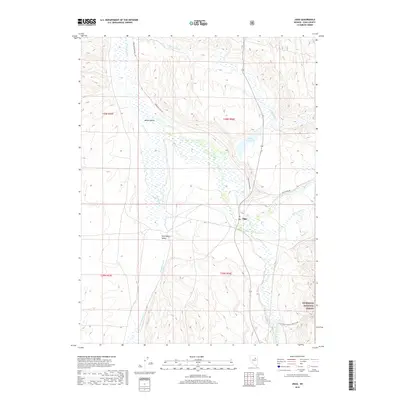
2018 Map of Jiggs
USGS Topo · Published 2018About this map
Mound Valley and Huntington Valley converge in this high-desert Elko County landscape, where the small settlement of Jiggs sits at the intersection of local routes and seasonal watercourses. The drainage patterns of Huntington Cr and Smith Cr dominate the central basin, feeding into the Zunino Reservoir. Historically significant travel is represented by Hamilton Stage Rd, a route that hints at the earlier transportation networks of the Nevada interior. The southeastern corner of the quadrangle rises into the protected boundaries of the Humboldt National Forest, where the terrain shifts from the valley floor to the more complex drainages of Corral Cr and Carville Cr. This survey captures the relationship between the low-lying wetlands and the mountain-flanked roads that define life in this corner of the Great Basin.
Find a feature on this map
19 named features on this map. Tap any name to fly to it.
Don’t see what you’re looking for? This feature index may not catch every label — zoom into the map to look around manually.
Map Details
Editions of this 2018 Jiggs Map
This is the sole edition of this map. No revisions or reprints were ever made.
Other maps of this area

1934 · Jiggs
USGS Topo · 1:125,000

1937 · Jiggs
USGS Topo · 1:125,000

1952 · Dixie Flats
USGS Topo · 1:62,500

1955 · Elko
USGS Topo · 1:250,000

1956 · Robinson Mtn
USGS Topo · 1:62,500

1958 · Elko
USGS Topo · 1:250,000

1959 · Jiggs
USGS Topo · 1:62,500

1962 · Elko
USGS Topo · 1:250,000

1962 · Lee
USGS Topo · 1:62,500

1965 · Elko
USGS Topo · 1:250,000