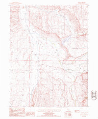
1985 Map of Jiggs
USGS Topo · Published 1986About this map
Mound Valley provides a wide basin for the winding path of Huntington Creek in this mid-1980s landscape south of Elko. The settlement of Jiggs serves as a small human footprint in a region defined by ranching and water management, located just west of the Zunino Reservoir. This provisional survey, compiled from late 1970s and early 1980s aerial photography, reveals a network of drainages including Smith Creek, McCutcheon Creek, and Gilbert Creek that flow from the surrounding heights toward the valley floor. The presence of the Circle L Ranch and various stock tanks underscores the agricultural utility of the land, while industrial features like a Gravel Pit and Sludge Pit indicate localized extraction and resource use within the township boundaries. This edition documents the rural infrastructure of Elko County before significant modern development, preserving the location of family-named watercourses such as Carville Creek.
Find a feature on this map
15 named features on this map. Tap any name to fly to it.
Don’t see what you’re looking for? This feature index may not catch every label — zoom into the map to look around manually.
Map Details
Editions of this 1985 Jiggs Map
This is the sole edition of this map. No revisions or reprints were ever made.
Other maps of this area

1934 · Jiggs
USGS Topo · 1:125,000

1937 · Jiggs
USGS Topo · 1:125,000

1952 · Dixie Flats
USGS Topo · 1:62,500

1955 · Elko
USGS Topo · 1:250,000

1956 · Robinson Mtn
USGS Topo · 1:62,500

1958 · Elko
USGS Topo · 1:250,000

1959 · Jiggs
USGS Topo · 1:62,500

1962 · Elko
USGS Topo · 1:250,000

1962 · Lee
USGS Topo · 1:62,500

1965 · Elko
USGS Topo · 1:250,000