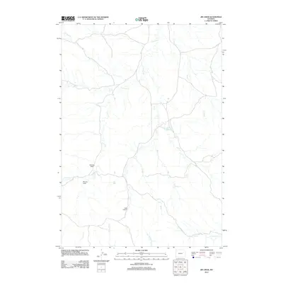
2012 Map of Jim Creek
USGS Topo · Published 2012About this map
Harrel Reservoir and the winding course of Jim Cr anchor this high plains landscape in northeastern Wyoming. The map details a complex drainage network where family-named features like Williams Draw and Murphy Draw define the local topography. This early 21st-century survey reveals a territory shaped by intermittent water sources and expansive rangeland, characterized by numerous prongs such as Peterson Prong and Newel Prong that feed into larger systems like Lodgepole Cr. The rugged descent of Hells Canyon stands out as a prominent landmark in the southern reaches, while the northern terrain is dissected by Four Horse Cr and Little Buck Cr. It is a landscape that preserves the naming conventions of early ranching and land use in Campbell County.
Find a feature on this map
17 named features on this map. Tap any name to fly to it.
Don’t see what you’re looking for? This feature index may not catch every label — zoom into the map to look around manually.
Map Details
Editions of this 2012 Jim Creek Map
This is the sole edition of this map. No revisions or reprints were ever made.
Other maps of this area

1918 · Moorcroft
USGS Topo · 1:125,000

1954 · Gillette
USGS Topo · 1:250,000

1955 · Newcastle
USGS Topo · 1:250,000

1955 · Gillette
USGS Topo · 1:250,000

1958 · Gillette
USGS Topo · 1:250,000

1958 · Newcastle
USGS Topo · 1:250,000

1962 · Gillette
USGS Topo · 1:250,000

1971 · Open A Ranch
USGS Topo · 1:24,000

1971 · Whitetail Creek
USGS Topo · 1:24,000

1971 · Rough Creek
USGS Topo · 1:24,000