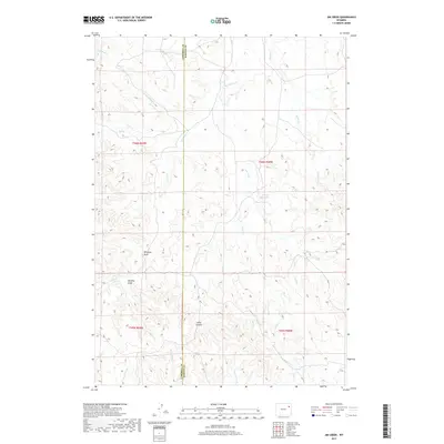
2017 Map of Jim Creek
USGS Topo · Published 2017About this map
The Campbell and Weston County line bisects this high plains landscape, where the drainage patterns of the Powder River Basin reveal a complex network of seasonal waterways and named landmarks. Harrel Reservoir stands out as a primary water source in this arid environment, surrounded by the intricate finger-like extensions of Baker Prong, Peterson Prong, and Newel Prong. This 2017 survey details the topographical nuances of the region's draws and canyons, most notably the dramatic Hells Canyon and the prominent Williams Draw. The map is a record of ranching country and resource management, tracing the paths of Jim Creek and Four Horse Creek as they navigate the ridges and valleys between the neighboring counties.
Find a feature on this map
24 named features on this map. Tap any name to fly to it.
Don’t see what you’re looking for? This feature index may not catch every label — zoom into the map to look around manually.
Map Details
Editions of this 2017 Jim Creek Map
This is the sole edition of this map. No revisions or reprints were ever made.
Other maps of this area

1918 · Moorcroft
USGS Topo · 1:125,000

1954 · Gillette
USGS Topo · 1:250,000

1955 · Newcastle
USGS Topo · 1:250,000

1955 · Gillette
USGS Topo · 1:250,000

1958 · Gillette
USGS Topo · 1:250,000

1958 · Newcastle
USGS Topo · 1:250,000

1962 · Gillette
USGS Topo · 1:250,000

1971 · Open A Ranch
USGS Topo · 1:24,000

1971 · Whitetail Creek
USGS Topo · 1:24,000

1971 · Rough Creek
USGS Topo · 1:24,000