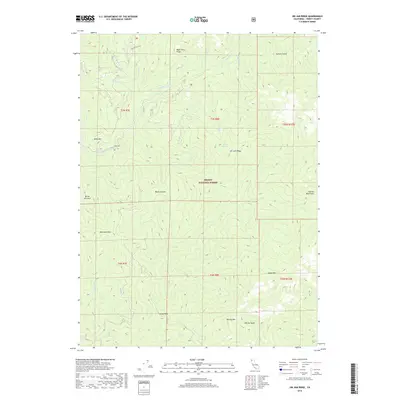
2018 Map of Jim Jam Ridge
USGS Topo · Published 2018About this map
Trinity National Forest encompasses this wilderness area in Northern California, defined by the deep drainage of the New River and its tributaries. The landscape is marked by the high elevations of the Salmon Mountains and distinctive landmarks such as Beartooth Mtn and China Peak. Access is limited to a few specific corridors, including Miller Ranch Rd in the north and Denny Rd to the west, reflecting the area's isolation and reliance on forest service infrastructure. Several named water sources, such as Jim Jam Spring and Whisky Cr, suggest historical points of interest for pack travel and early resource management. The map details a complex system of ridges and gulches, from Bake Oven Ridge to Semore Gulch, which have shaped the movement of both water and people through this part of Trinity County for decades.
Find a feature on this map
32 named features on this map. Tap any name to fly to it.
Don’t see what you’re looking for? This feature index may not catch every label — zoom into the map to look around manually.
Map Details
Editions of this 2018 Jim Jam Ridge Map
This is the sole edition of this map. No revisions or reprints were ever made.
Other maps of this area

1909 · Big Bar
USGS Topo · 1:96,000

1915 · Big Bar and Vicinity
USGS Topo · 1:250,000

1948 · Weed
USGS Topo · 1:250,000

1950 · Weed
USGS Topo · 1:250,000

1951 · Helena
USGS Topo · 1:62,500

1951 · Ironside Mountain
USGS Topo · 1:62,500

1955 · Salmon Mtn
USGS Topo · 1:62,500

1955 · Cecilville
USGS Topo · 1:62,500

1958 · Redding
USGS Topo · 1:250,000

1958 · Weed
USGS Topo · 1:250,000