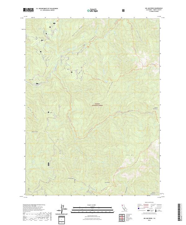
2022 Map of Jim Jam Ridge
USGS Topo · Published 2022About this map
Trinity National Forest encompasses this high-elevation landscape in Trinity County, where a complex network of ridgelines and deep gulches defines the territory. The northeastern corner is dominated by Bake Oven Ridge and Semore Gulch, while the southern reaches are anchored by China Peak and Green Mtn. This terrain is primarily accessible via foot and pack trails, such as the Jim Jam Trl, Devils Canyon Trl, and Green Mountain Trl, which wind through the forest to reach remote water sources like Jim Jam Spring.
Find a feature on this map
37 named features on this map. Tap any name to fly to it.
Don’t see what you’re looking for? This feature index may not catch every label — zoom into the map to look around manually.
Map Details
Editions of this 2022 Jim Jam Ridge Map
This is the sole edition of this map. No revisions or reprints were ever made.
Other maps of this area

1909 · Big Bar
USGS Topo · 1:96,000

1915 · Big Bar and Vicinity
USGS Topo · 1:250,000

1948 · Weed
USGS Topo · 1:250,000

1950 · Weed
USGS Topo · 1:250,000

1951 · Helena
USGS Topo · 1:62,500

1951 · Ironside Mountain
USGS Topo · 1:62,500

1955 · Salmon Mtn
USGS Topo · 1:62,500

1955 · Cecilville
USGS Topo · 1:62,500

1958 · Redding
USGS Topo · 1:250,000

1958 · Weed
USGS Topo · 1:250,000