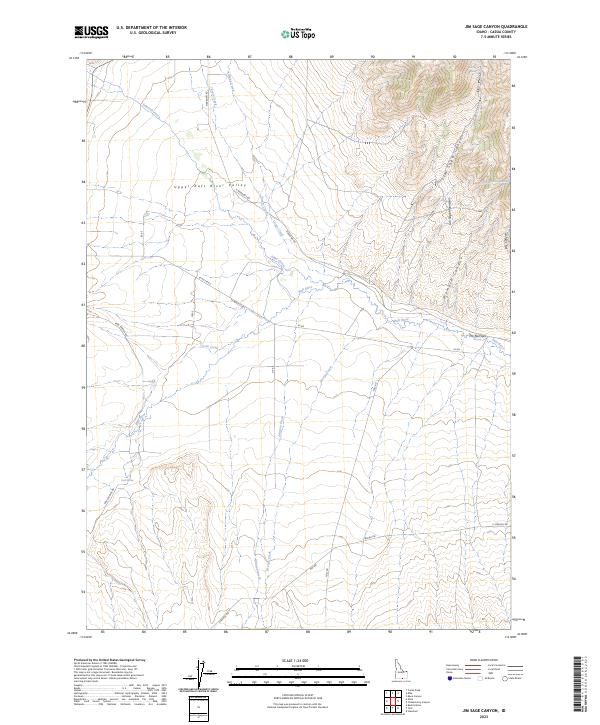
2023 Map of Jim Sage Canyon
USGS Topo · Published 2023About this map
Upper Raft River Valley is defined by a complex network of seasonal and perennial waterways draining from the high terrain of the Jim Sage Mountains. The landscape transitions from the broad, open valley floor to the sharp relief of Jim Sage Canyon and Womack Canyon in the east. Numerous water sources such as Jim Sage Spring, Reed Spring, and Womack Canyon Spring highlight the critical role of water management in this high-desert environment. The Raft River serves as the primary drainage, constricted by a notable geological formation at The Narrows. A grid of local routes like Narrows Rd and Strevell Rd provides access to the remote canyons and creek beds, including Edwards Creek and George Creek, supporting ranching and agricultural activities in this corner of Cassia County.
Find a feature on this map
35 named features on this map. Tap any name to fly to it.
Don’t see what you’re looking for? This feature index may not catch every label — zoom into the map to look around manually.
Map Details
Editions of this 2023 Jim Sage Canyon Map
This is the sole edition of this map. No revisions or reprints were ever made.
Other maps of this area

1954 · Pocatello
USGS Topo · 1:250,000

1954 · Brigham City
USGS Topo · 1:250,000

1958 · Pocatello
USGS Topo · 1:250,000

1958 · Brigham City
USGS Topo · 1:250,000

1959 · Park Valley
USGS Topo · 1:62,500

1959 · Yost
USGS Topo · 1:62,500

1962 · Brigham City
USGS Topo · 1:250,000

1968 · Almo
USGS Topo · 1:24,000

1968 · Cache Peak
USGS Topo · 1:24,000

1968 · Jim Sage Canyon
USGS Topo · 1:24,000