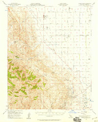
1956 Map of Joaquin Rocks
USGS Topo · Published 1959About this map
The rugged western edge of the San Joaquin Valley meets the Diablo Range in this 1950s survey, defined by the sharp geological transition of the Coalinga Anticline. To the east, the flat valley floor is organized by a rigid grid of agricultural avenues and large family-run holdings including Giffen Cantua Ranch, Terry Ranch, and Sunset Farms. This era shows the intensive development of the Coalinga Oil Field and the East Coalinga Extension Oil Field, where numerous wells and tanks mark the landscape of California's petroleum industry.
Find a feature on this map
51 named features on this map. Tap any name to fly to it.
Don’t see what you’re looking for? This feature index may not catch every label — zoom into the map to look around manually.
Map Details
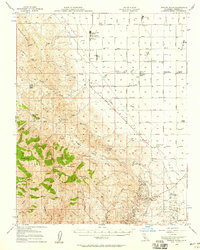
Editions of this 1956 Joaquin Rocks Map
2 editions found
Other maps of this area

1912 · Coalinga
USGS Topo · 1:125,000

1913 · Panoche
USGS Topo · 1:125,000

1915 · Priest Valley
USGS Topo · 1:125,000

1923 · Levis
USGS Topo · 1:31,680

1923 · Englebrecht Ranch
USGS Topo · 1:31,680

1923 · Monocline Ridge
USGS Topo · 1:31,680

1925 · San Joaquin
USGS Topo · 1:31,680

1928 · Delta Farms No 3
USGS Topo · 1:31,680

1931 · Towne Oil Station
USGS Topo · 1:31,680

1931 · Mouth of Cantua Creek
USGS Topo · 1:31,680