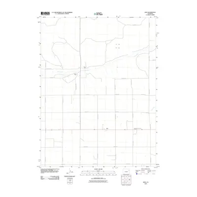
2010 Map of Joes
USGS Topo · Published 2010About this map
The settlement of Joes sits at the center of this rural Yuma County landscape, serving as a focal point for the surrounding agricultural community. The map details a sprawling grid of rural infrastructure, including an extensive network of county roads such as County Road D and County Road K that connect isolated homesteads and ranches. Local heritage is anchored by the Joes Mennonite Church Cemetery, located just east of the main town site, providing a valuable reference point for family historians and genealogists studying the area's religious and communal roots.
Find a feature on this map
23 named features on this map. Tap any name to fly to it.
Don’t see what you’re looking for? This feature index may not catch every label — zoom into the map to look around manually.
Map Details
Editions of this 2010 Joes Map
This is the sole edition of this map. No revisions or reprints were ever made.
Other maps of this area

1954 · Limon
USGS Topo · 1:250,000

1957 · Limon
USGS Topo · 1:250,000

1958 · Limon
USGS Topo · 1:250,000

1968 · Abarr SE
USGS Topo · 1:24,000

1968 · Joes
USGS Topo · 1:24,000

1968 · Adler Creek
USGS Topo · 1:24,000

1969 · Kirk
USGS Topo · 1:24,000

1974 · De Nova SE
USGS Topo · 1:24,000
1974 · Abarr
USGS Topo · 1:24,000

1977 · Cope
USGS Topo · 1:24,000