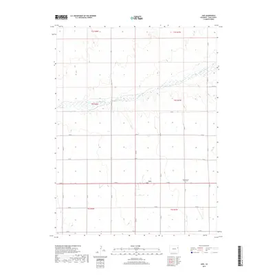
2019 Map of Joes
USGS Topo · Published 2019About this map
Joes is a small agricultural settlement situated in the heart of Yuma County, positioned along the southern edge of the Arikaree River basin. This survey documents the rural character of the eastern plains, where the landscape is defined by a rigid grid of county roads, including Co RD 6 and Co RD G, which navigate the subtle elevation changes of the high plains. The most significant community landmark is the Joes Mennonite Church Cem, located just east of the primary settlement. This cemetery and church site serve as a vital point of reference for local family history and genealogical research in this sparsely populated region of Colorado.
Find a feature on this map
24 named features on this map. Tap any name to fly to it.
Don’t see what you’re looking for? This feature index may not catch every label — zoom into the map to look around manually.
Map Details
Editions of this 2019 Joes Map
This is the sole edition of this map. No revisions or reprints were ever made.
Other maps of this area

1954 · Limon
USGS Topo · 1:250,000

1957 · Limon
USGS Topo · 1:250,000

1958 · Limon
USGS Topo · 1:250,000
1968 · Abarr SE
USGS Topo · 1:24,000
1968 · Joes
USGS Topo · 1:24,000
1968 · Adler Creek
USGS Topo · 1:24,000
1969 · Kirk
USGS Topo · 1:24,000
1974 · De Nova SE
USGS Topo · 1:24,000
1974 · Abarr
USGS Topo · 1:24,000
1977 · Cope
USGS Topo · 1:24,000