
1943 Map of John Day
USGS Topo · Published 1943About this map
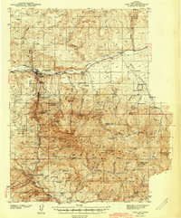
Canyon City and the neighboring settlement of John Day anchor this 1943 survey, which documents the mining and ranching economy of Grant County during the mid-twentieth century. The landscape is heavily marked by industrial history, featuring numerous extraction sites like the Potato Patch Mine and several labeled as defunct, such as the Golden West Mine (abandoned) and Iron King Mine (abandoned). These sites, concentrated along the flanks of Little Canyon Mtn and the Strawberry Mtn range, trace the legacy of gold and mineral prospecting in the region.
Find a feature on this map
77 named features on this map. Tap any name to fly to it.
Don’t see what you’re looking for? This feature index may not catch every label — zoom into the map to look around manually.
Map Details
Editions of this 1943 John Day Map
2 editions found
Other maps of this area

1940 · Mount Vernon
USGS Topo · 1:62,500

1940 · John Day
USGS Topo · 1:62,500

1943 · Mount Vernon
USGS Topo · 1:62,500

1949 · Long Creek
USGS Topo · 1:62,500

1949 · Susanville
USGS Topo · 1:62,500

1951 · Susanville
USGS Topo · 1:62,500

1951 · Long Creek
USGS Topo · 1:62,500

1951 · Bates
USGS Topo · 1:62,500

1955 · Canyon City
USGS Topo · 1:250,000

1959 · Canyon City
USGS Topo · 1:250,000