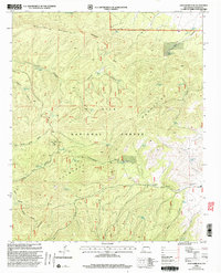
1999 Map of John Kerr Peak
USGS Topo · Published 2002About this map
John Kerr Peak rises as the dominant landmark in this high-altitude landscape within the Gila National Forest, where the Continental Divide winds through the Gila Mountains and Tularosa Mountains. This late 20th-century revision by the USDA Forest Service documents a complex network of water sources vital for land management and wildlife, including the Long Canyon Windmill, Damian Spring, and numerous catchment basins like Lopez Tank and Danley Tank.
Find a feature on this map
43 named features on this map. Tap any name to fly to it.
Don’t see what you’re looking for? This feature index may not catch every label — zoom into the map to look around manually.
Map Details
Editions of this 1999 John Kerr Peak Map
This is the sole edition of this map. No revisions or reprints were ever made.
Other maps of this area

1915 · Reserve
USGS Topo · 1:125,000

1918 · Pelona
USGS Topo · 1:125,000

1918 · Reserve
USGS Topo · 1:125,000

1954 · Clifton
USGS Topo · 1:250,000

1957 · Clifton
USGS Topo · 1:250,000

1958 · Clifton
USGS Topo · 1:250,000

1962 · Clifton
USGS Topo · 1:250,000
1965 · Aragon
USGS Topo · 1:24,000
1965 · Eagle Peak
USGS Topo · 1:24,000
1965 · Squirrel Springs Canyon
USGS Topo · 1:24,000