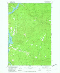
1981 Map of John Lewis
USGS Topo · Published 1982About this map
John Lewis sits at the center of this Clearwater County landscape, a region defined by the winding reaches of the N Fk Dworshak Reservoir and the Clearwater Reservoir. The 1981 data reflects a period of established water management and recreational infrastructure, featuring a Campground near Canoe Creek and Boathouse Cr. Evidence of remote operations appears at Old Camp B and a nearby Landing Strip, while the terrain is marked by prominent elevations such as Bear Butte and Lightning Points. The map also captures the industrial activity of the era through a Quarry and Borrow Pit, alongside numerous watercourses like Silver Creek, Evans Creek, and Reeds Creek that carve through the high ridges of Harris Ridge and the open expanse of Fiftynine Meadow.
Find a feature on this map
37 named features on this map. Tap any name to fly to it.
Don’t see what you’re looking for? This feature index may not catch every label — zoom into the map to look around manually.
Map Details
Editions of this 1981 John Lewis Map
2 editions found
Other maps of this area

1923 · Washington Creek
USGS Topo · 1:125,000

1936 · Boehls Butte
USGS Topo · 1:48,000

1938 · Headquarters
USGS Topo · 1:48,000

1943 · Boehls Butte
USGS Topo · 1:62,500

1944 · Headquarters
USGS Topo · 1:62,500

1955 · Pullman
USGS Topo · 1:250,000

1956 · Hamilton
USGS Topo · 1:250,000

1958 · Pullman
USGS Topo · 1:250,000

1959 · Hamilton
USGS Topo · 1:250,000

1960 · Hamilton
USGS Topo · 1:250,000