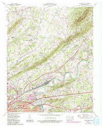
1978 Map of John Sevier
USGS Topo · Published 1993About this map
The Holston River carves a winding path through this Knox County landscape, separating the suburban growth of Knoxville and Burlington from the older rural ridges to the north. Settlement patterns here are defined by the parallel elevations of Mc Annaly Ridge and Blackoak Ridge, with historic transit corridors like Rutledge Pike and the Southern Railway facilitating local industry and trade. A significant amount of local history is preserved in small family and community burial grounds, including the Old Poor Farm Cem and Strong Cem, which sit alongside established institutions like the Midwest Medical Nursing Institute. The presence of the County Penal Farm and a sewage disposal plant near John Sevier reflects the area's mid-century role in supporting the infrastructure of the nearby city while maintaining its distinct rural character in places like Harbison Crossroads.
Find a feature on this map
65 named features on this map. Tap any name to fly to it.
Don’t see what you’re looking for? This feature index may not catch every label — zoom into the map to look around manually.
Map Details
Editions of this 1978 John Sevier Map
2 editions found
Other maps of this area

1886 · Knoxville
USGS Topo · 1:125,000

1892 · Knoxville
USGS Topo · 1:125,000

1894 · Knoxville
USGS Topo · 1:125,000

1895 · Knoxville
USGS Topo · 1:125,000

1897 · Maynardville
USGS Topo · 1:125,000

1900 · Maynardville
USGS Topo · 1:125,000

1901 · Knoxville
USGS Topo · 1:125,000

1935 · Luttrell
USGS Topo · 1:24,000

1935 · Mascot
USGS Topo · 1:24,000

1935 · Knoxville
USGS Topo · 1:48,000