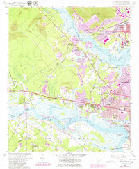
1958 Map of Johns Island
USGS Topo · Published 1979About this map
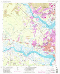
Drayton Hall and the historic estate of Magnolia Gardens stand along the Ashley River, anchoring a landscape transitioning from rural estates to suburban expansion. The 1979 revisions highlight significant growth in Saint Andrews and North Charleston, where residential developments like Wando Woods and Waylyn fill the spaces between the river and the Southern Railway. Public and institutional land use is prominent, including the Clemson College Experiment Farm and the County Prison Farm. Near Cowhead Reach and Wappoo Creek, the map details a complex coastal geography of marshes and islands, including Johns Island and James Island. This survey captures the mid-century infrastructure of the Seaboard Coast Line Railroad alongside local landmarks like Fort Bull and several community churches such as Lovely Hill Ch and St Phillips Ch.
Find a feature on this map
71 named features on this map. Tap any name to fly to it.
Don’t see what you’re looking for? This feature index may not catch every label — zoom into the map to look around manually.
Map Details
Editions of this 1958 Johns Island Map
5 editions found
Other maps of this area

1919 · Ladson
USGS Topo · 1:21,120

1919 · Johns Island
USGS Topo · 1:21,120

1919 · Wadmelaw Island
USGS Topo · 1:62,500

1919 · Melgrove
USGS Topo · 1:21,120

1919 · Charleston
USGS Topo · 1:21,120

1919 · James Island
USGS Topo · 1:21,120

1919 · Legareville
USGS Topo · 1:21,120

1920 · Ravenels
USGS Topo · 1:62,500

1940 · Melgrove
USGS Topo · 1:24,000

1943 · Legareville
USGS Topo · 1:24,000