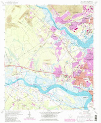
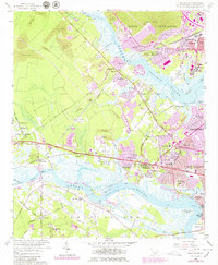
1958 Map of Johns Island
USGS Topo · Published 1979About this map
Drayton Hall and the banks of the Ashley River anchor this mid-century look at the expansion of west Charleston. The landscape is a study in transition, where established riverfront sites like Drayton and the historical Fort Bull meet the encroaching urban footprints of North Charleston and Saint Andrews. The map details the complex tidal ecology of Cowhead Reach and West Marsh I, contrasted by the heavy industry of numerous strip mines operating in the northwest.
Find a feature on this map
77 named features on this map. Tap any name to fly to it.
Don’t see what you’re looking for? This feature index may not catch every label — zoom into the map to look around manually.
Map Details
Editions of this 1958 Johns Island Map
5 editions found
Other maps of this area

1919 · Ladson
USGS Topo · 1:21,120

1919 · Johns Island
USGS Topo · 1:21,120

1919 · Wadmelaw Island
USGS Topo · 1:62,500

1919 · Melgrove
USGS Topo · 1:21,120

1919 · Charleston
USGS Topo · 1:21,120

1919 · James Island
USGS Topo · 1:21,120

1919 · Legareville
USGS Topo · 1:21,120

1920 · Ravenels
USGS Topo · 1:62,500

1940 · Melgrove
USGS Topo · 1:24,000

1943 · Legareville
USGS Topo · 1:24,000