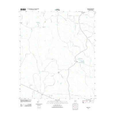
2012 Map of Johns
USGS Topo · Published 2012About this map
Johns and the small settlements of Rufus and Cross Roads anchor this rural landscape in eastern Rankin County during the early 21st century. The map reveals a community deeply tied to its geography, with numerous small burial grounds such as Shiloh Cem, Silverena Cem, and Antioch Cem scattered among the timbered ridges. Notable elevations include Indian Mound Hill and Big Buck Rdg, while the Shiloh Lookout Tower stands as a landmark for forest observation north of the main settlement. The drainage patterns of Puruis Cr, Walters Cr, and Campbell Cr define the local topography, feeding into man-made features like Carr-Williams Lake and Diamond D Lake. This map serves as an excellent resource for understanding the persistence of small family-named roads and rural infrastructure in this part of Mississippi.
Find a feature on this map
61 named features on this map. Tap any name to fly to it.
Don’t see what you’re looking for? This feature index may not catch every label — zoom into the map to look around manually.
Map Details
Editions of this 2012 Johns Map
This is the sole edition of this map. No revisions or reprints were ever made.
Other maps of this area

1922 · Morton
USGS Topo · 1:48,000

1922 · Pelahatchee
USGS Topo · 1:48,000

1924 · Pelahatchee
USGS Topo · 1:62,500

1924 · Morton
USGS Topo · 1:62,500

1935 · White Oak
USGS Topo · 1:24,000

1950 · Pelahatchie
USGS Topo · 1:62,500

1951 · Morton
USGS Topo · 1:62,500

1952 · Pelahatchie
USGS Topo · 1:62,500

1953 · Meridian
USGS Topo · 1:250,000

1957 · Meridian
USGS Topo · 1:250,000