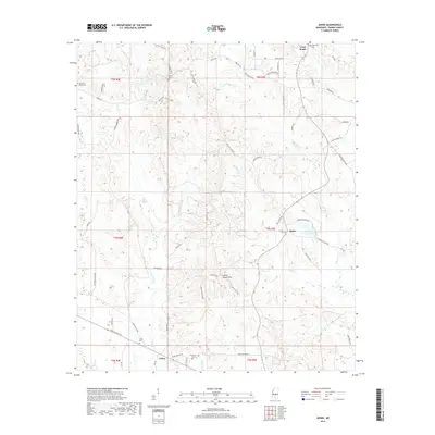
2018 Map of Johns
USGS Topo · Published 2018About this map
Johns and its surrounding countryside in Rankin County are characterized by a network of rural roads and scattered family cemeteries that define the local landscape. The terrain transitions between prominent elevations like Coyote Ridge and the Indian Mound Ridge, which includes the notable Indian Mound Hill. Waterways such as Purvis Cr and Walters Cr carve through the land, feeding into small impoundments like Carr-Williams Lake and Diamond D Lake. Small community hubs at Cross Roads and Rufus connect via historically named routes such as Gulde Shiloh Rd and the Johns-Mayton Rd. For those tracing local history or genealogy, the presence of numerous burial grounds, including Silverena Cem and Mountain Ridge Cem, suggests long-standing family settlements tied to these specific rural corridors.
Find a feature on this map
66 named features on this map. Tap any name to fly to it.
Don’t see what you’re looking for? This feature index may not catch every label — zoom into the map to look around manually.
Map Details
Editions of this 2018 Johns Map
This is the sole edition of this map. No revisions or reprints were ever made.
Other maps of this area

1922 · Morton
USGS Topo · 1:48,000

1922 · Pelahatchee
USGS Topo · 1:48,000

1924 · Pelahatchee
USGS Topo · 1:62,500

1924 · Morton
USGS Topo · 1:62,500

1935 · White Oak
USGS Topo · 1:24,000

1950 · Pelahatchie
USGS Topo · 1:62,500

1951 · Morton
USGS Topo · 1:62,500

1952 · Pelahatchie
USGS Topo · 1:62,500

1953 · Meridian
USGS Topo · 1:250,000

1957 · Meridian
USGS Topo · 1:250,000