
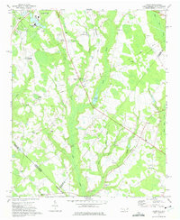
1971 Map of Johns
USGS Topo · Published 1975About this map
The sprawling campus of St Andrews College and the southern edge of Laurinburg define the northern portion of this 1971 survey. The landscape transitions into a network of lowlands and creek beds, including Leith Creek and Shoe Heel Creek, which drain the borderlands between North and South Carolina. This region is characterized by a dense distribution of rural institutions, such as South Scotland Sch and the Stewartsville Cem, alongside numerous country churches including Smyrna Ch and Jerusalem Ch.
Find a feature on this map
48 named features on this map. Tap any name to fly to it.
Don’t see what you’re looking for? This feature index may not catch every label — zoom into the map to look around manually.
Map Details
Editions of this 1971 Johns Map
2 editions found
Other maps of this area

1942 · Rockingham
USGS Topo · 1:125,000

1949 · Gibson
USGS Topo · 1:24,000

1949 · Laurinburg
USGS Topo · 1:24,000

1949 · Wakulla
USGS Topo · 1:24,000

1949 · Hamlet
USGS Topo · 1:62,500

1949 · Laurinburg
USGS Topo · 1:62,500

1953 · Florence
USGS Topo · 1:250,000

1954 · Florence
USGS Topo · 1:250,000

1957 · Laurinburg
USGS Topo · 1:24,000

1971 · Minturn
USGS Topo · 1:24,000