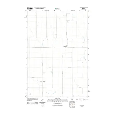
2010 Map of Johnson
USGS Topo · Published 2010About this map
Johnson anchors this portion of Big Stone County, appearing as a quiet agricultural hub defined by its straight-line road grid and the presence of the Johnson Post Office. The surrounding landscape is dominated by sophisticated water management systems, including County Ditch Number Eleven and County Ditch Number Eight, which speak to the region's long-standing reliance on drained prairie land for farming. To the south, the Moonshine Lakebed marks a significant topographical feature, indicating how the natural hydrology of the area has been altered over time. Local history is grounded at the Trinity Cemetery in the northern section of the map, while the West Fork Twelvemile Creek meanders across the eastern edge, providing one of the few natural drainage routes in a territory otherwise governed by the precision of county highways.
Find a feature on this map
16 named features on this map. Tap any name to fly to it.
Don’t see what you’re looking for? This feature index may not catch every label — zoom into the map to look around manually.
Map Details
Editions of this 2010 Johnson Map
This is the sole edition of this map. No revisions or reprints were ever made.
Other maps of this area

1910 · Chokio
USGS Topo · 1:62,500

1912 · Chokio
USGS Topo · 1:62,500

1950 · Graceville
USGS Topo · 1:62,500

1953 · Ortonville
USGS Topo · 1:62,500

1953 · Milbank
USGS Topo · 1:250,000

1958 · Milbank
USGS Topo · 1:250,000

1968 · Artichoke Lake NW
USGS Topo · 1:24,000

1971 · Dismal Swamp
USGS Topo · 1:24,000
1971 · Clinton
USGS Topo · 1:24,000
1973 · Chokio NW
USGS Topo · 1:24,000