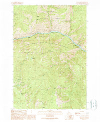
1989 Map of Johnson Butte
USGS Topo · Published 1990About this map
The Salmon River cuts a deep path through central Idaho, serving as the primary dividing line between massive wilderness tracts in the late 1980s. This survey illustrates the convergence of the Gospel Hump Wilderness, the Frank Church River of No Return Wilderness, and portions of the Payette National Forest. Along the river, treacherous water features like Little Growler Rapids, Canopener Rapids, and Dried Meat Rapids are carefully noted, alongside the historic river passage at Indian Crossing. To the south, the landscape is punctuated by numerous mining claims situated in the high terrain, including the Sherman-Howell Mine, Golden Anchor Mine, and Leadville Mine. These sites, tucked near peaks like Black Butte and Johnson Butte, reflect a legacy of hard-rock mineral extraction deep within the national forest system.
Find a feature on this map
42 named features on this map. Tap any name to fly to it.
Don’t see what you’re looking for? This feature index may not catch every label — zoom into the map to look around manually.
Map Details
Editions of this 1989 Johnson Butte Map
This is the sole edition of this map. No revisions or reprints were ever made.
Other maps of this area

1931 · Buffalo Hump
USGS Topo · 1:125,000

1934 · Buffalo Hump
USGS Topo · 1:125,000

1956 · Burgdorf
USGS Topo · 1:62,500

1956 · Warren
USGS Topo · 1:62,500

1956 · Elk City
USGS Topo · 1:250,000

1960 · Elk City
USGS Topo · 1:250,000

1963 · Hanover Mtn.
USGS Topo · 1:24,000

1963 · Marble Butte
USGS Topo · 1:24,000

1979 · Buffalo Hump
USGS Topo · 1:24,000

1981 · Warren
USGS Topo · 1:100,000