
1963 Map of Marble Butte
USGS Topo · Published 1965About this map
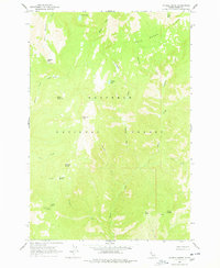
Nez Perce National Forest dominates this mid-century survey, showcasing a landscape defined by high peaks and strategic lookout points. The Square Mtn Lookout atop Square Mountain stands as a primary landmark, overseeing a network of steep drainages including Peterson Creek and Taylor Creek. The terrain is characterized by high-altitude meadows such as Anchor Meadow and Long Meadow, which provide breaks in the heavy timber. Water sources are critical features of this high country, from the larger Twin Lakes and Hidden Lake to smaller, named seeps like Sweet Anise Spring. The presence of several distinct peaks, including Sheep Mountain, Plummer Point, and Marble Butte, indicates a region primarily utilized for forest management and fire observation rather than permanent settlement or industry during the early 1960s.
Find a feature on this map
28 named features on this map. Tap any name to fly to it.
Don’t see what you’re looking for? This feature index may not catch every label — zoom into the map to look around manually.
Map Details
Editions of this 1963 Marble Butte Map
3 editions found
Other maps of this area

1931 · Buffalo Hump
USGS Topo · 1:125,000

1934 · Buffalo Hump
USGS Topo · 1:125,000

1956 · Burgdorf
USGS Topo · 1:62,500

1956 · Warren
USGS Topo · 1:62,500

1956 · Elk City
USGS Topo · 1:250,000

1960 · Elk City
USGS Topo · 1:250,000

1963 · Sourdough Peak
USGS Topo · 1:24,000

1963 · Hanover Mtn.
USGS Topo · 1:24,000
1963 · Sawyer Ridge
USGS Topo · 1:24,000

1979 · Buffalo Hump
USGS Topo · 1:24,000