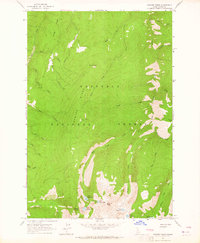
1963 Map of Sawyer Ridge
USGS Topo · Published 1965About this map
Nez Perce National Forest dominates this mid-century topographic study, defined by the high-elevation terrain of Sawyer Ridge and the Nez Perce Ridge. The landscape is a complex network of glacial cirques and drainages, where multiple high-country lakes like Upper Gospel Lake and Lower Knob Lake sit beneath prominent summits such as Pyramid Peak and Dome Hill. This map captures the area as it was managed in the early 1960s, prior to modern wilderness designations, showing the essential infrastructure of forest management including the Sawyer Ridge Lookout and a remote outpost at Bentz Cow Camp. The drainage patterns are clearly defined by numerous watercourses such as Hungry Creek, West Fork Gospel Creek, and Moores Lake Creek, which carve through the steep ridges. A single Jeep Trail provides the primary access route across the southern portion of the sheet near Gospel Hill, reflecting the limited human footprint in this interior mountain environment.
Find a feature on this map
36 named features on this map. Tap any name to fly to it.
Don’t see what you’re looking for? This feature index may not catch every label — zoom into the map to look around manually.
Map Details
Editions of this 1963 Sawyer Ridge Map
3 editions found
Other maps of this area

1931 · Buffalo Hump
USGS Topo · 1:125,000

1934 · Buffalo Hump
USGS Topo · 1:125,000

1955 · Grangeville
USGS Topo · 1:250,000

1956 · Elk City
USGS Topo · 1:250,000

1959 · Grangeville
USGS Topo · 1:250,000

1960 · Elk City
USGS Topo · 1:250,000

1963 · Sourdough Peak
USGS Topo · 1:24,000

1963 · Goodwin Meadows
USGS Topo · 1:24,000

1963 · Hanover Mtn.
USGS Topo · 1:24,000

1963 · Huddleson Bluff
USGS Topo · 1:24,000