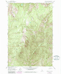
1963 Map of Marble Butte
USGS Topo · Published 1987About this map
Nez Perce National Forest high country defines this 1963 survey, where alpine lakes and sharp peaks characterize the interior of the Clearwater Mountains. High-elevation landmarks such as Square Mountain and Square Mtn Lookout overlook a network of glaciated basins, including Twin Lakes and Square Mountain Lake. The map illustrates the topographic complexity of the Gospel Hump Wilderness before its formal designation, showing established trail points and natural springs like Sweet Anise Spring. The drainage patterns are meticulously recorded, with Hagen Creek and Peterson Creek carving deep valleys between prominent ridges like Bear Grass Ridge. Local relief is highlighted by isolated summits such as Marble Butte and North Butte, providing essential context for the land management practices of the mid-20th century in this protected Idaho landscape.
Find a feature on this map
32 named features on this map. Tap any name to fly to it.
Don’t see what you’re looking for? This feature index may not catch every label — zoom into the map to look around manually.
Map Details
Editions of this 1963 Marble Butte Map
3 editions found
Other maps of this area

1931 · Buffalo Hump
USGS Topo · 1:125,000

1934 · Buffalo Hump
USGS Topo · 1:125,000

1956 · Burgdorf
USGS Topo · 1:62,500

1956 · Warren
USGS Topo · 1:62,500

1956 · Elk City
USGS Topo · 1:250,000

1960 · Elk City
USGS Topo · 1:250,000

1963 · Sourdough Peak
USGS Topo · 1:24,000

1963 · Hanover Mtn.
USGS Topo · 1:24,000

1963 · Marble Butte
USGS Topo · 1:24,000
1963 · Sawyer Ridge
USGS Topo · 1:24,000