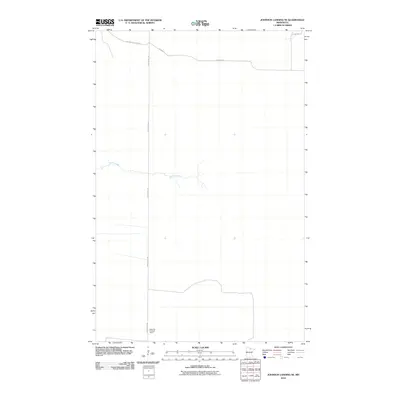
2010 Map of Johnson Landing SE
USGS Topo · Published 2010About this map
Rock Cut Lookout Tower stands as a primary landmark in this northern Minnesota landscape, marking a high point for regional fire surveillance. This 2010 survey of the area southeast of Johnson Landing reveals a terrain structured by forestry and drainage, where the long vertical of the Deer River Line boundary cuts through the central woods. The slow-moving waters of Reilly Creek meander across the central section, illustrating the low-relief drainage patterns typical of the region. A network of timber and access routes, including the Cut Across Forest Rd and Nelson Rd, provides the necessary infrastructure for land management in this sparsely populated portion of Koochiching County.
Find a feature on this map
6 named features on this map. Tap any name to fly to it.
Don’t see what you’re looking for? This feature index may not catch every label — zoom into the map to look around manually.
Map Details
Editions of this 2010 Johnson Landing SE Map
This is the sole edition of this map. No revisions or reprints were ever made.
Other maps of this area

1919 · M
USGS Topo · 1:62,500

1954 · Hibbing
USGS Topo · 1:250,000

1954 · International Falls
USGS Topo · 1:250,000

1957 · Hibbing
USGS Topo · 1:250,000

1957 · International Falls
USGS Topo · 1:250,000

1958 · International Falls
USGS Topo · 1:250,000

1958 · Hibbing
USGS Topo · 1:250,000

1964 · Hibbing
USGS Topo · 1:250,000

1970 · Johnson Landing SE
USGS Topo · 1:24,000
1970 · Nett Lake River West
USGS Topo · 1:24,000