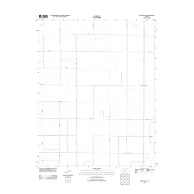
2012 Map of Johnson NE
USGS Topo · Published 2012About this map
The High Plains landscape of Stanton County is defined by a strict orthogonal grid of rural roads and the subtle drainage patterns of intermittent waterways. Little Bear Cr meanders across the northern section of the terrain, while Bear Ck cuts through the southeastern corner, providing a natural contrast to the geometric precision of the township-and-range survey system. This area, dominated by agricultural land use, relies on a vast network of numbered and lettered routes such as Co Road K, Road P, and W Road 5. The distribution of scattered structures along these corridors reflects the sparse, large-scale farming characteristic of Western Kansas in the early 21st century. Researchers can use this map to identify specific property access points and the relationship between local water sources and the established road hierarchy.
Find a feature on this map
23 named features on this map. Tap any name to fly to it.
Don’t see what you’re looking for? This feature index may not catch every label — zoom into the map to look around manually.
Map Details
Editions of this 2012 Johnson NE Map
This is the sole edition of this map. No revisions or reprints were ever made.
Other maps of this area

1900 · Syracuse
USGS Topo · 1:125,000

1920 · Syracuse
USGS Topo · 1:125,000

1955 · Dodge City
USGS Topo · 1:250,000

1958 · Dodge City
USGS Topo · 1:250,000

1959 · Dodge City
USGS Topo · 1:250,000

1959 · Big Bow NW
USGS Topo · 1:24,000

1959 · Big Bow SW
USGS Topo · 1:24,000

1966 · Syracuse West SW
USGS Topo · 1:24,000

1966 · Syracuse East SW
USGS Topo · 1:24,000
1966 · Syracuse West SE
USGS Topo · 1:24,000