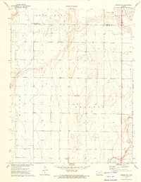
1973 Map of Johnson NE
USGS Topo · Published 1975About this map
Bear Creek and Little Bear Creek carve through the High Plains landscape of Western Kansas, marking the drainage patterns across the Hamilton and Stanton County line. The terrain is characterized by a high frequency of wells, signaling the vital role of groundwater extraction in this semi-arid agricultural region during the early 1970s. Local transit and infrastructure are represented by the small Cockrum Airport and the community of Parks, while a Gaging Station on the lower reach of the creek monitor's the area's intermittent water flow. A small Sandpit in the southeast corner provides evidence of local industrial material extraction. The map also includes several specific benchmarks, such as BM Hellwig, which offer valuable fixed points for genealogists or surveyors tracing property lines and historical land use in this sparsely populated stretch of the Great Plains.
Find a feature on this map
18 named features on this map. Tap any name to fly to it.
Don’t see what you’re looking for? This feature index may not catch every label — zoom into the map to look around manually.
Map Details
Editions of this 1973 Johnson NE Map
This is the sole edition of this map. No revisions or reprints were ever made.
Other maps of this area

1900 · Syracuse
USGS Topo · 1:125,000

1920 · Syracuse
USGS Topo · 1:125,000

1955 · Dodge City
USGS Topo · 1:250,000

1958 · Dodge City
USGS Topo · 1:250,000

1959 · Dodge City
USGS Topo · 1:250,000

1959 · Big Bow NW
USGS Topo · 1:24,000

1959 · Big Bow SW
USGS Topo · 1:24,000

1966 · Syracuse West SW
USGS Topo · 1:24,000

1966 · Syracuse East SW
USGS Topo · 1:24,000
1966 · Syracuse West SE
USGS Topo · 1:24,000