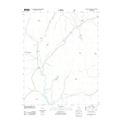
2011 Map of Johnson Shut-Ins
USGS Topo · Published 2011About this map
Johnson Shut-Ins State Park anchors this terrain in Reynolds County, where the East Fork Black River carves through the landscape. This 2011 survey reveals the specialized infrastructure of the region, specifically the Upper Pool and Lower Pool associated with the Taum Sauk Upper Dam. These features, along with the Perdido Dam and Middlebrook Development Lake Dam, illustrate the significant hydro-engineering present in this part of the Ozarks.
Find a feature on this map
36 named features on this map. Tap any name to fly to it.
Don’t see what you’re looking for? This feature index may not catch every label — zoom into the map to look around manually.
Map Details
Editions of this 2011 Johnson Shut-Ins Map
This is the sole edition of this map. No revisions or reprints were ever made.
Other maps of this area

1924 · Edgehill
USGS Topo · 1:62,500

1926 · Edgehill
USGS Topo · 1:62,500

1926 · Des Arc
USGS Topo · 1:62,500

1929 · Des Arc
USGS Topo · 1:62,500

1937 · Ironton
USGS Topo · 1:48,000

1943 · Lesterville
USGS Topo · 1:62,500

1945 · Ironton
USGS Topo · 1:62,500

1946 · Lesterville
USGS Topo · 1:62,500

1946 · Ironton
USGS Topo · 1:62,500

1949 · Rolla
USGS Topo · 1:250,000