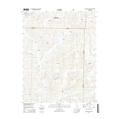
2015 Map of Johnson Shut-Ins
USGS Topo · Published 2015About this map
Monterey and the small settlement of Munger define the settled pockets of this corner of the Saint Francois Mountains. This terrain is dominated by high peaks and steep hollows, including Proffit Mtn, Bell Mtn, and Church Mtn. The landscape is notably marked by the engineering of the Upper Reservoir and Lower Reservoir, which utilize the natural drop in elevation near Taum Sauk Cr for power generation. For those tracing family histories in the region, several small burial sites are documented across the hills, such as Chapman Cemetery, Hasty Cemetery, and Fitzgerald Cemetery. These sites, along with the East Fork Black River, illustrate a community shaped by the narrow valleys and the bounds of the Mark Twain National Forest.
Find a feature on this map
46 named features on this map. Tap any name to fly to it.
Don’t see what you’re looking for? This feature index may not catch every label — zoom into the map to look around manually.
Map Details
Editions of this 2015 Johnson Shut-Ins Map
This is the sole edition of this map. No revisions or reprints were ever made.
Other maps of this area

1924 · Edgehill
USGS Topo · 1:62,500

1926 · Edgehill
USGS Topo · 1:62,500

1926 · Des Arc
USGS Topo · 1:62,500

1929 · Des Arc
USGS Topo · 1:62,500

1937 · Ironton
USGS Topo · 1:48,000

1943 · Lesterville
USGS Topo · 1:62,500

1945 · Ironton
USGS Topo · 1:62,500

1946 · Lesterville
USGS Topo · 1:62,500

1946 · Ironton
USGS Topo · 1:62,500

1949 · Rolla
USGS Topo · 1:250,000