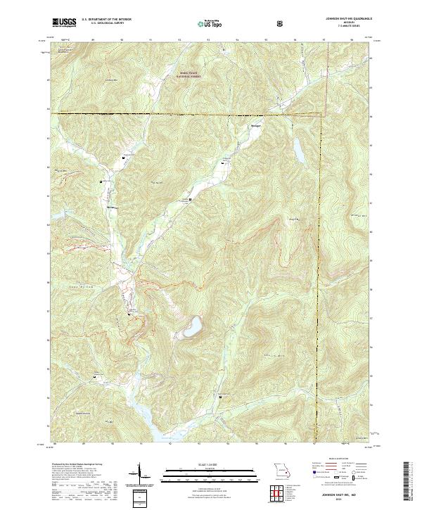
2021 Map of Johnson Shut-Ins
USGS Topo · Published 2021About this map
Mark Twain National Forest dominates this section of the Saint Francois Mountains, where the E Fork Black River cuts through the high relief of the Missouri Ozarks. Small family cemeteries like the Johnston Family Cem and Fitzgerald Cem are tucked into the drainages of Cope Hollow and Womble Hollow, providing essential coordinates for genealogists. The settlement of Monterey sits at a crossroads along State Hwy MM, while Munger is positioned near the northern county line. This 2021 survey shows a landscape heavily defined by its recreation and water management infrastructure, including the Lower Reservoir and the Scour Trl, a feature that marks the site of the Taum Sauk reservoir breach and the subsequent geological scouring of the valley floor. High elevations like Proffit Mtn and Church Mtn hem in the river valley, which is crisscrossed by the extensive Ozark Trl system.
Find a feature on this map
57 named features on this map. Tap any name to fly to it.
Don’t see what you’re looking for? This feature index may not catch every label — zoom into the map to look around manually.
Map Details
Editions of this 2021 Johnson Shut-Ins Map
This is the sole edition of this map. No revisions or reprints were ever made.
Other maps of this area

1924 · Edgehill
USGS Topo · 1:62,500

1926 · Edgehill
USGS Topo · 1:62,500

1926 · Des Arc
USGS Topo · 1:62,500

1929 · Des Arc
USGS Topo · 1:62,500

1937 · Ironton
USGS Topo · 1:48,000

1943 · Lesterville
USGS Topo · 1:62,500

1945 · Ironton
USGS Topo · 1:62,500

1946 · Lesterville
USGS Topo · 1:62,500

1946 · Ironton
USGS Topo · 1:62,500

1949 · Rolla
USGS Topo · 1:250,000