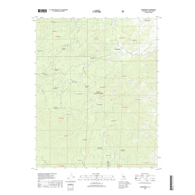
2018 Map of Johnsondale
USGS Topo · Published 2018About this map
Johnsondale serves as the primary hub within this high-elevation landscape, situated among the massive granite features and timbered reaches of the Sequoia National Forest. The map detail reveals a specialized mountain geography defined by extensive meadows, which likely supported grazing and early seasonal encampments. Notable among these are Redwood Meadow, French Joe Meadow, and Packsaddle Meadow, each nestled within the drainage basins of the Sierra Nevada. The transport network relies heavily on Forest Service routes and historical paths like Deer Creek Mill Rd, tracing the complex terrain between Elephant Knob and the Greenhorn Mountains. This 2018 survey provides an intricate look at the hydrology of the southern Sierra, documenting numerous sources such as Lion Spring and alpine features like Ida Lake that feed the creek systems winding through Flynn Canyon and Scarlet and Davis Canyon.
Find a feature on this map
64 named features on this map. Tap any name to fly to it.
Don’t see what you’re looking for? This feature index may not catch every label — zoom into the map to look around manually.
Map Details
Editions of this 2018 Johnsondale Map
This is the sole edition of this map. No revisions or reprints were ever made.
Other maps of this area

1904 · Kaweah
USGS Topo · 1:125,000

1905 · Olancha
USGS Topo · 1:125,000

1905 · Fairview
USGS Topo · 1:24,000

1906 · Kernville
USGS Topo · 1:125,000

1907 · Olancha
USGS Topo · 1:125,000

1908 · Kernville
USGS Topo · 1:125,000

1909 · Kaweah
USGS Topo · 1:125,000

1918 · Fairview
USGS Topo · 1:31,680

1936 · Tobias Peak
USGS Topo · 1:125,000

1937 · Kaweah
USGS Topo · 1:125,000