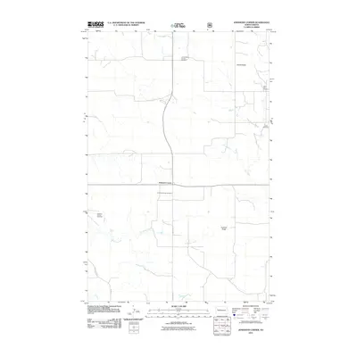
2011 Map of Johnsons Corner
USGS Topo · Published 2011About this map
Johnsons Corner serves as the focal point of this McKenzie County landscape, where the intersection of State Route 23 and County Rte 53 anchors a rural community defined by its energy production and agricultural heritage. The presence of the Camel Buttes Oil and Gas Field and the Pershing Oil and Gas Field highlights the region's importance to North Dakota's extractive industry. This 2011 survey documents a land where industrial activity meets established family roots, evidenced by several burial grounds including Johnsons Corner Cemetery, Silent City Cemetery, and Union Cemetery. The natural topography is shaped by the drainage of Dry Creek and Northfork Creek, with prominent rises such as Saddle Butte and Kummer Ridge providing vertical relief to the high plains. The map captures the rectilinear grid of local roads like County Hwy 45, characteristic of the Great Plains' section-line development.
Find a feature on this map
13 named features on this map. Tap any name to fly to it.
Don’t see what you’re looking for? This feature index may not catch every label — zoom into the map to look around manually.
Map Details
Editions of this 2011 Johnsons Corner Map
This is the sole edition of this map. No revisions or reprints were ever made.
Other maps of this area

1953 · Watford City
USGS Topo · 1:250,000

1957 · Watford City
USGS Topo · 1:250,000

1959 · Croff
USGS Topo · 1:24,000

1959 · Lone Butte NE
USGS Topo · 1:24,000

1965 · Keene
USGS Topo · 1:24,000

1965 · Johnsons Corner
USGS Topo · 1:24,000

1965 · Blue Buttes
USGS Topo · 1:24,000

1965 · Blue Buttes SE
USGS Topo · 1:24,000

1967 · Watford City
USGS Topo · 1:250,000

1970 · Figure 4 Ranch
USGS Topo · 1:24,000