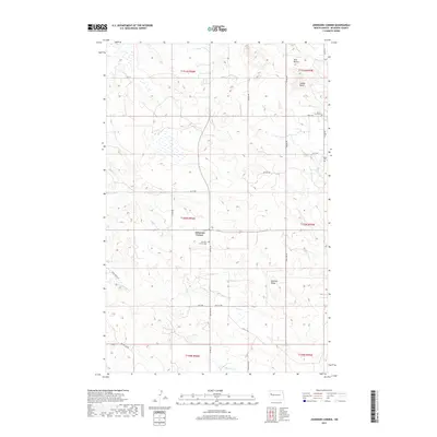
2017 Map of Johnsons Corner
USGS Topo · Published 2017About this map
Johnsons Corner serves as the central point of reference in this high-plains landscape of McKenzie County, where the topography is defined by the prominent Blue Buttes and Saddle Butte in the northern reaches. The area is marked by a network of drainage systems, including Northfork Cr, Bear Den Cr, and Dry Cr, which carve through the terrain near Kummer Ridge. Genealogists will find several burial sites preserved on this sheet, notably the Johnsons Corner Cem, Silent City Cem, and Union Cem. The map reflects a modern infrastructure of county routes and section-line roads like Stone Johny Rd and Beaver Crk Rd, illustrating how the agricultural and energy-producing regions of North Dakota are organized around these vital transportation corridors.
Find a feature on this map
35 named features on this map. Tap any name to fly to it.
Don’t see what you’re looking for? This feature index may not catch every label — zoom into the map to look around manually.
Map Details
Editions of this 2017 Johnsons Corner Map
This is the sole edition of this map. No revisions or reprints were ever made.
Other maps of this area

1953 · Watford City
USGS Topo · 1:250,000

1957 · Watford City
USGS Topo · 1:250,000

1959 · Croff
USGS Topo · 1:24,000

1959 · Lone Butte NE
USGS Topo · 1:24,000

1965 · Keene
USGS Topo · 1:24,000

1965 · Johnsons Corner
USGS Topo · 1:24,000

1965 · Blue Buttes
USGS Topo · 1:24,000

1965 · Blue Buttes SE
USGS Topo · 1:24,000

1967 · Watford City
USGS Topo · 1:250,000

1970 · Figure 4 Ranch
USGS Topo · 1:24,000