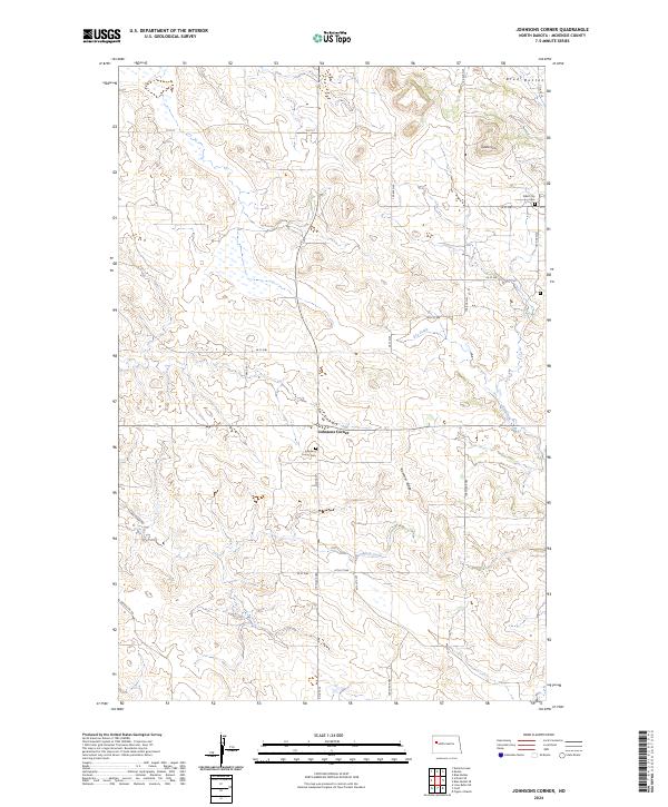
2024 Map of Johnsons Corner
USGS Topo · Published 2024About this map
Johnsons Corner serves as the focal point of this modern survey in McKenzie County, situated at the intersection of Co Rte 53 and Co Rte 14. The landscape is defined by the high, rolling terrain of the Blue Buttes and the prominent Saddle Butte in the northeast, transitioning down toward Northfork Creek and Dry Creek. This area of the Williston Basin maintains a quiet rural character, where local history is anchored by the Johnsons Corner Cem and the Silent City Cem. The map illustrates a grid of secondary roads and section lines, including 108 Ave NW and 25th ST NW, which reflect the enduring public land survey system. Geologic features like Kummer Ridge dominate the central topography, providing a detailed look at the drainage patterns and elevations that have shaped ranching and life in this part of North Dakota.
Find a feature on this map
32 named features on this map. Tap any name to fly to it.
Don’t see what you’re looking for? This feature index may not catch every label — zoom into the map to look around manually.
Map Details
Editions of this 2024 Johnsons Corner Map
This is the sole edition of this map. No revisions or reprints were ever made.
Other maps of this area

1953 · Watford City
USGS Topo · 1:250,000

1957 · Watford City
USGS Topo · 1:250,000

1959 · Croff
USGS Topo · 1:24,000

1959 · Lone Butte NE
USGS Topo · 1:24,000

1965 · Keene
USGS Topo · 1:24,000

1965 · Johnsons Corner
USGS Topo · 1:24,000

1965 · Blue Buttes
USGS Topo · 1:24,000

1965 · Blue Buttes SE
USGS Topo · 1:24,000

1967 · Watford City
USGS Topo · 1:250,000

1970 · Figure 4 Ranch
USGS Topo · 1:24,000