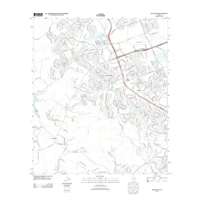
2013 Map of Jollyville
USGS Topo · Published 2013About this map
Jollyville and its surrounding suburban communities sit at a geographic crossroads north of Austin during this 2013 survey. The map details the dense residential development of the Jollyville Plateau, where newer neighborhoods like those along S Lakeline Blvd and Sunchase Blvd overlay a landscape once defined by smaller settlements. Local heritage is preserved in sites such as Pond Springs Cem and Jollyville Cem, which sit near the modern commercial corridors. To the west, the terrain drops toward the eastern reaches of Lake Travis, where Bullick Hollow and Comanche Peak provide a stark contrast to the plateau's urbanization. Notable water features like House Springs Swimming Spring and the winding course of Bull Cr illustrate the area's hydrology, while named landmarks like Anderson Mill and Four Points mark the evolution of this region from rural outposts to a major residential hub.
Find a feature on this map
305 named features on this map. Tap any name to fly to it.
Don’t see what you’re looking for? This feature index may not catch every label — zoom into the map to look around manually.
Map Details
Editions of this 2013 Jollyville Map
This is the sole edition of this map. No revisions or reprints were ever made.
Other maps of this area

1893 · Georgetown
USGS Topo · 1:125,000

1896 · Austin
USGS Topo · 1:125,000

1897 · Austin
USGS Topo · 1:125,000

1910 · Austin
USGS Topo · 1:125,000

1928 · Round Rock
USGS Topo · 1:62,500

1930 · Austin-2
USGS Topo · 1:48,000

1932 · Mt. Bonnell
USGS Topo · 1:62,500

1949 · Round Rock
USGS Topo · 1:62,500

1951 · Round Rock
USGS Topo · 1:62,500

1954 · Austin East
USGS Topo · 1:24,000