
1949 Map of Round Rock
USGS Topo · Published 1967About this map
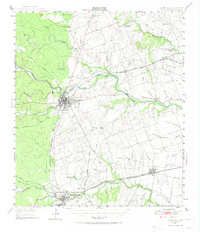
Georgetown sits at the confluence of the forks of the San Gabriel River, serving as a focal point for commerce and rail transport in Williamson County during the mid-century. The landscape is defined by the convergence of the Missouri Kansas and Texas and the International Great Northern railroads, which facilitated the movement of goods from rural outposts like Walburg and Weir to larger markets. To the south, the community of Round Rock is depicted alongside its predecessor, Old Round Rock, showing the shift of settlement patterns toward the rail corridor.
Find a feature on this map
45 named features on this map. Tap any name to fly to it.
Don’t see what you’re looking for? This feature index may not catch every label — zoom into the map to look around manually.
Map Details
Editions of this 1949 Round Rock Map
2 editions found
Other maps of this area

1885 · Taylor
USGS Topo · 1:125,000

1885 · Bastrop
USGS Topo · 1:125,000

1887 · Taylor
USGS Topo · 1:125,000

1893 · Georgetown
USGS Topo · 1:125,000

1893 · Bastrop
USGS Topo · 1:125,000

1894 · Taylor
USGS Topo · 1:125,000

1896 · Austin
USGS Topo · 1:125,000

1897 · Austin
USGS Topo · 1:125,000

1904 · Bastrop
USGS Topo · 1:125,000

1910 · Austin
USGS Topo · 1:125,000