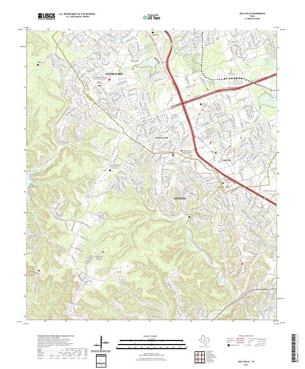
2022 Map of Jollyville
USGS Topo · Published 2022About this map
Cedar Park and the northern reaches of Austin dominate this landscape where the Williamson Co Travis Co line bisects suburban development. The area is defined by a transition from the dense residential grids around Anderson Mill and Jollyville to the dramatic relief of the Jollyville Plateau. To the southwest, the terrain drops into deep drainages like Bullick Hollow, Panther Hollow, and Defeat Hollow, which feed toward Bull Creek.
Find a feature on this map
47 named features on this map. Tap any name to fly to it.
Don’t see what you’re looking for? This feature index may not catch every label — zoom into the map to look around manually.
Map Details
Editions of this 2022 Jollyville Map
This is the sole edition of this map. No revisions or reprints were ever made.
Other maps of this area

1893 · Georgetown
USGS Topo · 1:125,000

1896 · Austin
USGS Topo · 1:125,000

1897 · Austin
USGS Topo · 1:125,000

1910 · Austin
USGS Topo · 1:125,000

1928 · Round Rock
USGS Topo · 1:62,500

1930 · Austin-2
USGS Topo · 1:48,000

1932 · Mt. Bonnell
USGS Topo · 1:62,500

1949 · Round Rock
USGS Topo · 1:62,500

1951 · Round Rock
USGS Topo · 1:62,500

1954 · Austin East
USGS Topo · 1:24,000