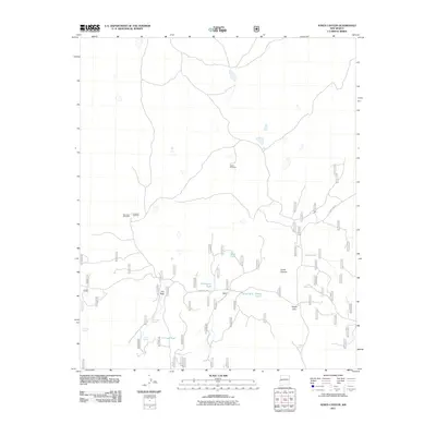
2011 Map of Jones Canyon
USGS Topo · Published 2011About this map
Jones Canyon and the surrounding high desert of Catron County define this 2011 survey, where the geography of water determines the footprint of human activity. The landscape is marked by a network of vital water sources and collection points such as Beard Tank and Orona Tank, which supported the region's ranching interests. Named landmarks like the Martin Windmill and Bevorosa Windmill serve as critical navigation points across the terrain, while natural features like Hay Vega and Knight Gap indicate the varied topography of the area. A sophisticated system of forest roads, including Forest Rd 205 and Forest Rd 19, provides access to these remote locations. The placement of Tin Cup Spring and Canovas Spring alongside these routes reflects the enduring importance of traditional water rights and land use in this part of New Mexico.
Find a feature on this map
17 named features on this map. Tap any name to fly to it.
Don’t see what you’re looking for? This feature index may not catch every label — zoom into the map to look around manually.
Map Details
Editions of this 2011 Jones Canyon Map
This is the sole edition of this map. No revisions or reprints were ever made.
Other maps of this area

1886 · St Johns
USGS Topo · 1:250,000

1892 · St Johns
USGS Topo · 1:250,000

1915 · Reserve
USGS Topo · 1:125,000

1918 · Reserve
USGS Topo · 1:125,000

1922 · Nutrioso
USGS Topo · 1:125,000

1954 · Clifton
USGS Topo · 1:250,000

1954 · Saint Johns
USGS Topo · 1:250,000

1955 · Red Hill
USGS Topo · 1:24,000

1957 · Clifton
USGS Topo · 1:250,000

1957 · Saint Johns
USGS Topo · 1:250,000