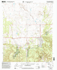
1999 Map of Jones Canyon
USGS Topo · Published 2002About this map
Apache National Forest lands dominate this high-elevation landscape, where seasonal water management is the primary marker of human presence. The terrain is defined by a system of natural basins and man-made improvements including Laguna Verde, Laguna de la Manzana, and Martin Reservoir. These features, along with specialized infrastructure like the Bevorosa Windmill and Mesa Storage Tank, suggest a landscape utilized for livestock grazing within the National Forest System.
Find a feature on this map
35 named features on this map. Tap any name to fly to it.
Don’t see what you’re looking for? This feature index may not catch every label — zoom into the map to look around manually.
Map Details
Editions of this 1999 Jones Canyon Map
This is the sole edition of this map. No revisions or reprints were ever made.
Other maps of this area

1886 · St Johns
USGS Topo · 1:250,000

1892 · St Johns
USGS Topo · 1:250,000

1915 · Reserve
USGS Topo · 1:125,000

1918 · Reserve
USGS Topo · 1:125,000

1922 · Nutrioso
USGS Topo · 1:125,000

1954 · Clifton
USGS Topo · 1:250,000

1954 · Saint Johns
USGS Topo · 1:250,000

1955 · Red Hill
USGS Topo · 1:24,000

1957 · Clifton
USGS Topo · 1:250,000

1957 · Saint Johns
USGS Topo · 1:250,000