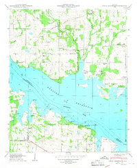
1950 Map of Jones Crossroads
USGS Topo · Published 1950About this map
Wheeler Reservoir Tennessee River dominates the center of this 1950 survey, marking a transformed river landscape where the Tennessee Valley Authority's influence is clear. The water's edge is dotted with recreational and community-focused areas such as the Finley Island Cabin Site Area and the Wheeler Reservation Boundary. Away from the shoreline, the map reveals a rural landscape deeply rooted in family history, evidenced by a dense distribution of small cemeteries including Neville Cem, Burt Cem, and Peck Cem.
Find a feature on this map
44 named features on this map. Tap any name to fly to it.
Don’t see what you’re looking for? This feature index may not catch every label — zoom into the map to look around manually.
Map Details
Editions of this 1950 Jones Crossroads Map
3 editions found
Other maps of this area

1888 · Huntsville
USGS Topo · 1:125,000

1892 · Huntsville
USGS Topo · 1:125,000

1935 · Athens
USGS Topo · 1:24,000

1936 · Caddo
USGS Topo · 1:24,000

1936 · Decatur
USGS Topo · 1:24,000

1936 · Stewart Cross Roads
USGS Topo · 1:24,000

1936 · Ripley
USGS Topo · 1:24,000

1936 · Trinity
USGS Topo · 1:24,000

1936 · Hillsboro
USGS Topo · 1:24,000

1936 · Tanner
USGS Topo · 1:24,000