
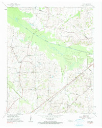
1961 Map of Jones
USGS Topo · Published 1963About this map
The South Fork Forked Deer River meanders across this West Tennessee landscape, defining the boundary between Crockett and Haywood counties. This early 1960s survey illustrates a rural society organized around small crossroads communities and family-named landmarks. The Louisville and Nashville railroad cuts through the southern half of the quadrangle, passing through the settlement of Allens and near the Antioch Church. The map is particularly dense with community institutions, featuring numerous schools like the Shelton White School and Bradford School, alongside local churches such as Wortham Chapel and Taylor Chapel. This era precedes significant industrial consolidation, showing a landscape of small farms connected by routes like Cane Ridge Road and the Nashville and Northwestern Road. Genealogists will find value in the specific placement of the Wortham Chapel Cemetery and Hess Cemetery among the woodlots and wetlands.
Find a feature on this map
50 named features on this map. Tap any name to fly to it.
Don’t see what you’re looking for? This feature index may not catch every label — zoom into the map to look around manually.
Map Details
Editions of this 1961 Jones Map
2 editions found
Other maps of this area

1939 · Halls
USGS Topo · 1:62,500

1950 · Sunnyhill
USGS Topo · 1:24,000

1950 · Brownsville
USGS Topo · 1:24,000

1951 · Brownsville
USGS Topo · 1:24,000

1951 · Sunnyhill
USGS Topo · 1:24,000

1952 · Chestnut Bluff
USGS Topo · 1:24,000

1956 · Blytheville
USGS Topo · 1:250,000

1959 · Blytheville
USGS Topo · 1:250,000

1959 · Bells
USGS Topo · 1:24,000

1959 · Denmark
USGS Topo · 1:24,000