
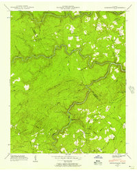
1936 Map of Jones Knob
USGS Topo · Published 1936About this map
Cumberland Plateau terrain dominates this 1936 advance sheet, where the network of the Tennessee Basin is defined by deeply incised watercourses like Clear Creek and Bucklick Creek. This survey, a collaboration between the Tennessee Valley Authority and the USGS, documents a landscape prior to major modernization, characterized by isolated rural institutions and river crossings. Essential community points such as Jones Sch and Cold Spring Sch appear alongside numerous family-named landmarks and water sources, including Boiling Spring, Houston Spring, and Sulphur Spring. The reliance on local river navigation and transport is evident through several documented crossings, specifically Jones Ford, Turner Ford, and Ashburn Ford. These points of transit, often located where branches like Myatt Creek or Glade Branch meet the main stem, illustrate the localized movement patterns of residents in Fentress, Morgan, and Cumberland counties during the mid-1930s.
Find a feature on this map
37 named features on this map. Tap any name to fly to it.
Don’t see what you’re looking for? This feature index may not catch every label — zoom into the map to look around manually.
Map Details
Editions of this 1936 Jones Knob Map
This is the sole edition of this map. No revisions or reprints were ever made.
Other maps of this area

1895 · Wartburg
USGS Topo · 1:125,000

1896 · Wartburg
USGS Topo · 1:125,000

1897 · Standingstone
USGS Topo · 1:125,000

1898 · Standingstone
USGS Topo · 1:125,000

1935 · Isoline
USGS Topo · 1:24,000

1935 · Clarkrange
USGS Topo · 1:24,000

1936 · Hebbertsburg
USGS Topo · 1:24,000

1936 · Fox Creek
USGS Topo · 1:24,000

1936 · Twin Bridges
USGS Topo · 1:24,000
1943 · Hebbertsburg
USGS Topo · 1:24,000