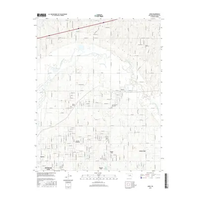
2016 Map of Jones
USGS Topo · Published 2016About this map
The North Canadian River meanders across this landscape, defining the character of the terrain northeast of Oklahoma City. The map documents several established communities and smaller settlements, including Jones, Nicoma Park, and Green Pastures, which are connected by a dense grid of residential streets and arterial roads like N Douglas Blvd. This region is notable for its numerous memorial sites and cemeteries, such as the Chitwood Cem and the Jones Independent Order of Odd Fellows Cem, which offer significant value for genealogical research.
Find a feature on this map
52 named features on this map. Tap any name to fly to it.
Don’t see what you’re looking for? This feature index may not catch every label — zoom into the map to look around manually.
Map Details
Editions of this 2016 Jones Map
This is the sole edition of this map. No revisions or reprints were ever made.
Other maps of this area

1892 · Moore
USGS Topo · 1:62,500

1892 · Edmond
USGS Topo · 1:62,500

1898 · Purcell
USGS Topo · 1:125,000

1909 · Luther
USGS Topo · 1:62,500

1930 · McLoud
USGS Topo · 1:62,500

1934 · Crutcho Creek
USGS Topo · 1:24,000

1934 · Moore
USGS Topo · 1:62,500

1935 · Spencer
USGS Topo · 1:24,000

1935 · Edmond
USGS Topo · 1:48,000

1938 · Moore
USGS Topo · 1:62,500