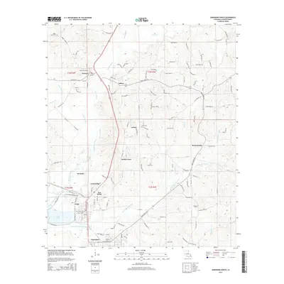
2015 Map of Jonesboro North
USGS Topo · Published 2015About this map
The Dugdemona River and its tributary, the Little Dugdemona River, define the landscape of northern Jackson Parish in this 2015 survey. The map details a dense corridor of settlements along the primary north-south highway, including the industrial hub of Hodge, as well as North Hodge, East Hodge, and the northern edge of Jonesboro. This area exhibits a distinct transition from these concentrated residential and industrial zones to more dispersed rural communities such as Punkin Center, Hilltop, and Beech Springs.
Find a feature on this map
124 named features on this map. Tap any name to fly to it.
Don’t see what you’re looking for? This feature index may not catch every label — zoom into the map to look around manually.
Map Details
Editions of this 2015 Jonesboro North Map
This is the sole edition of this map. No revisions or reprints were ever made.
Other maps of this area

1947 · Goldonna
USGS Topo · 1:62,500

1947 · Bienville
USGS Topo · 1:62,500

1949 · Bienville
USGS Topo · 1:62,500

1949 · Jonesboro
USGS Topo · 1:62,500

1950 · Jonesboro
USGS Topo · 1:62,500

1953 · Hodge
USGS Topo · 1:62,500

1955 · Shreveport
USGS Topo · 1:250,000

1956 · Shreveport
USGS Topo · 1:250,000

1957 · Goldonna
USGS Topo · 1:62,500

1984 · Shreveport
USGS Topo · 1:250,000